Togo vs. the Mercator Map: A Fight to Resize Africa on the World Stage
17:31 15.04.2026 (Updated: 18:10 15.04.2026)

© Statista
Subscribe
Togo vs. the Mercator Map: A Fight to Resize Africa on the World Stage
Togo is pushing the UN to abandon the centuries-old Mercator projection, and a draft resolution to promote a more accurate map is being prepared, with a likely vote at the next UNGA in September, according to FM Robert Dussey.
"The size we see of the African continent on the globe... is geographically inaccurate," he told a British media outlet.
Here’s why it matters — broken down:
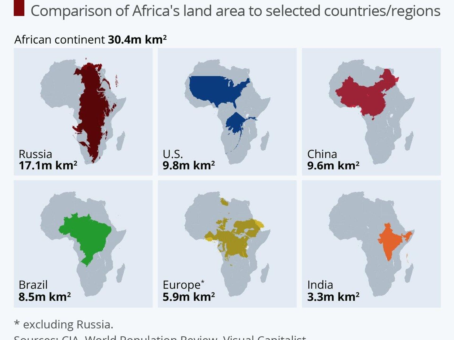
▪How Mercator differs from reality: Created in 1569 for navigation, the Mercator projection distorts land sizes—inflating the Global North while shrinking Africa, which is actually 14 times larger than Greenland appears on the map.
▪Geopolitical and perceptual impact: The Mercator map's distortion reinforces Eurocentric views and skews perceptions of the continent's true scale and significance, according to AU officials and campaign activists.
▪The proposed solution — Equal Earth projection: Developed in 2018, the Equal Earth projection shows continents at their accurate relative sizes while keeping shapes familiar and visually practical—offering a fairer, more usable alternative to Mercator.
▪The "Correct the Map" campaign: Endorsed by the African Union and led by Togo, this campaign urges governments, schools, and global institutions to adopt accurate maps and update curricula.
Togo is pushing the UN to abandon the centuries-old Mercator projection, and a draft resolution to promote a more accurate map is being prepared, with a likely vote at the next UNGA in September, according to FM Robert Dussey.
"The size we see of the African continent on the globe... is geographically inaccurate," he told a British media outlet.
Here’s why it matters — broken down:
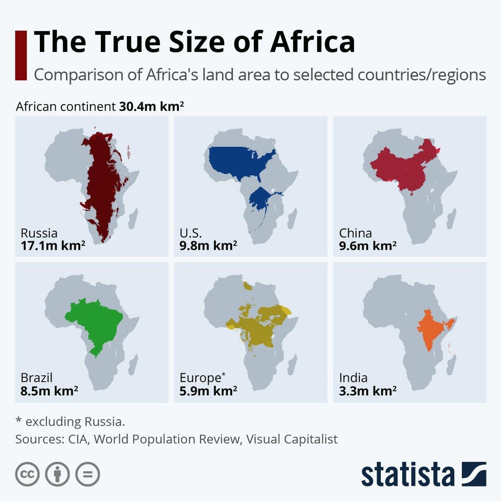
▪How Mercator differs from reality: Created in 1569 for navigation, the Mercator projection distorts land sizes—inflating the Global North while shrinking Africa, which is actually 14 times larger than Greenland appears on the map.
▪Geopolitical and perceptual impact: The Mercator map's distortion reinforces Eurocentric views and skews perceptions of the continent's true scale and significance, according to AU officials and campaign activists.
▪The proposed solution — Equal Earth projection: Developed in 2018, the Equal Earth projection shows continents at their accurate relative sizes while keeping shapes familiar and visually practical—offering a fairer, more usable alternative to Mercator.
▪The "Correct the Map" campaign: Endorsed by the African Union and led by Togo, this campaign urges governments, schools, and global institutions to adopt accurate maps and update curricula.

