https://en.sputniknews.africa/20231029/marathon-vs-sprint-scientists-identified-two-modes-of-hurricane-rapid-intensification-1063176501.html
Marathon vs Sprint: Scientists Identified Two Modes of Hurricane Rapid Intensification
Marathon vs Sprint: Scientists Identified Two Modes of Hurricane Rapid Intensification
Sputnik Africa
Forecasters have long struggled to explain why a seemingly typical tropical depression can suddenly transform into a major hurricane, bringing catastrophic... 29.10.2023, Sputnik Africa
2023-10-29T16:52+0100
2023-10-29T16:52+0100
2023-10-29T17:04+0100
natural disaster
nature
nature reserve
science
research
storm
international
https://cdn1.img.sputniknews.africa/img/07e7/0a/1d/1063177070_0:292:2001:1417_1920x0_80_0_0_d3ba1e12eecef20492bfb8f76f0942dd.jpg
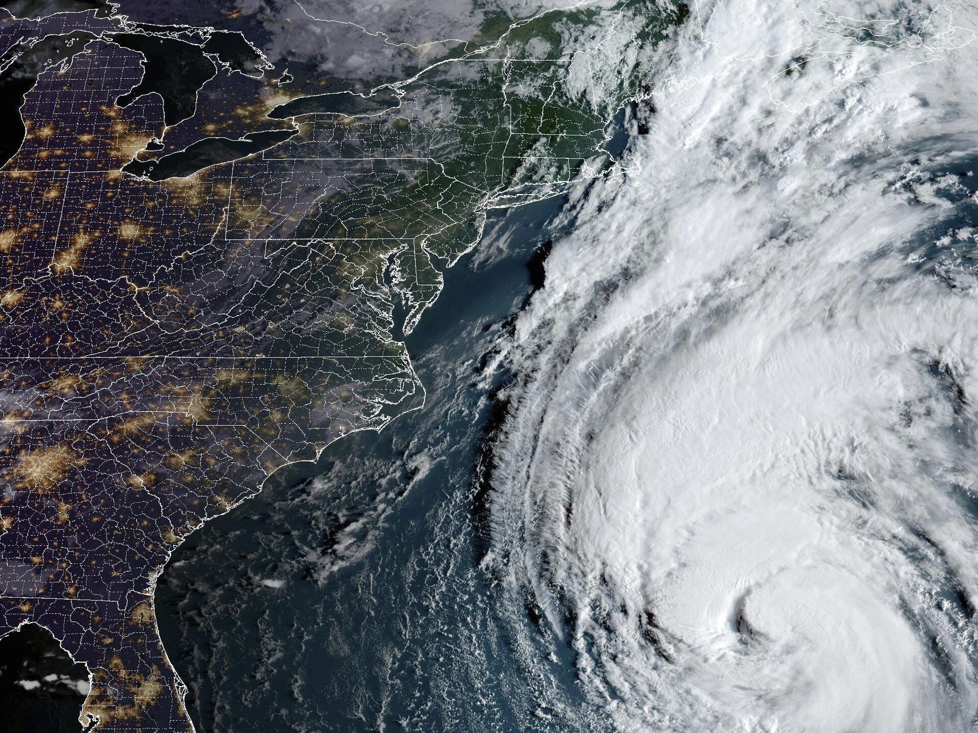
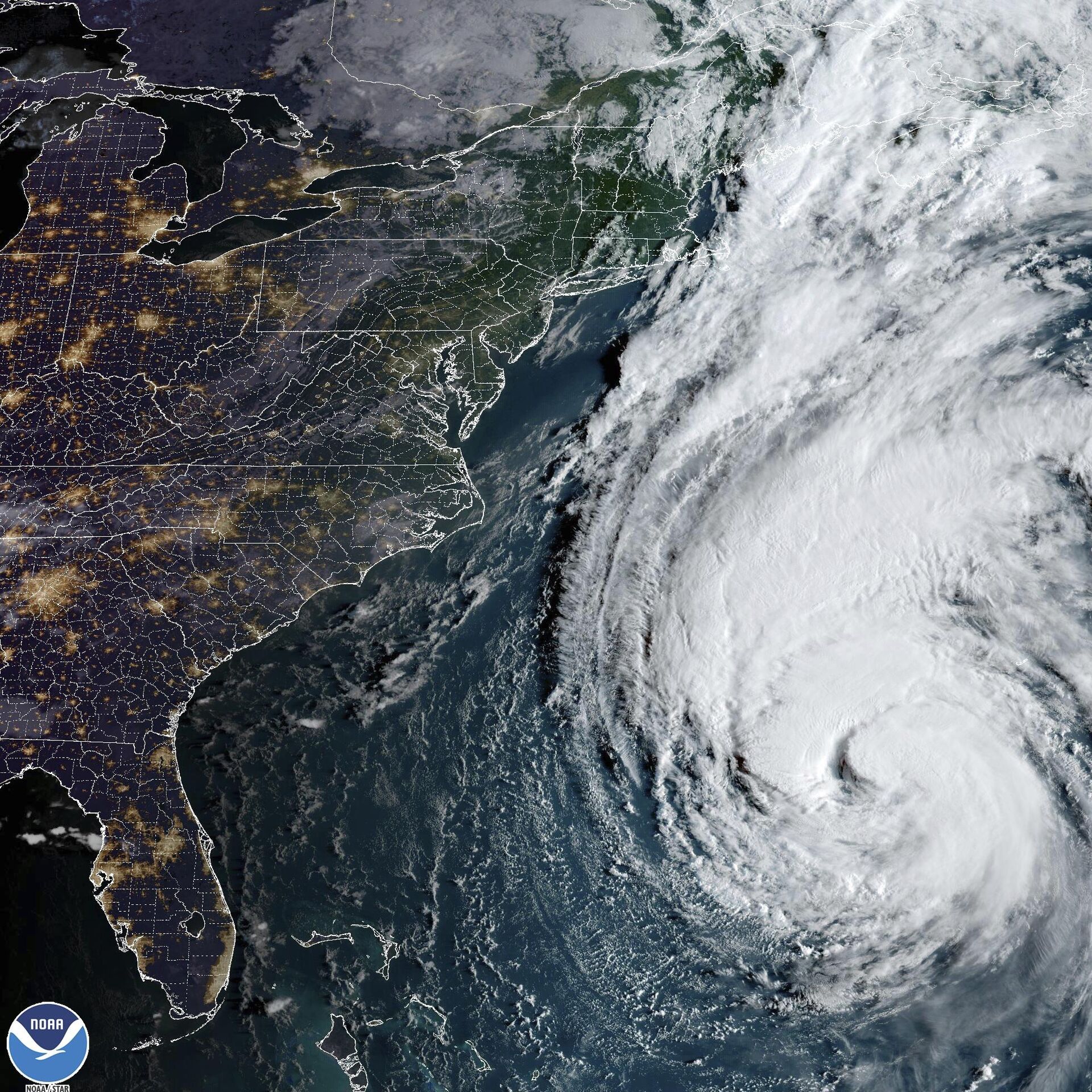
There's more than one mechanism that causes tropical cyclones to intensify abruptly, resulting in what is known as "rapid intensification", a new study by scientists at the US National Science Foundation (NSF) National Center for Atmospheric Research (NCAR) has revealed. The research paper, published in the Monthly Weather Review, a journal of the American Meteorological Society, uses the latest computer modeling techniques to identify two different modes of rapid intensification.Rapid intensification happens when the wind speed of a tropical cyclone increases by 30 knots (approximately 35 miles per hour) within a 24-hour timeframe. The discovery of the two modes occurred when Judt created a 40-day high-resolution computer simulation of the global atmosphere, using the Model for Prediction Across Scales (MPAS). Judt was interested in examining storms in the simulation that swiftly intensified. Through studying numerous instances across the world's ocean basins, he discovered that rapid intensification took place in two ways. Judt and his co-authors reviewed observations of tropical cyclones and found real instances of both modes of rapid intensification.Meteorologists have long been aware that certain environmental conditions, such as high surface water temperature and low wind shear, can result in rapid intensification of cyclones, ultimately leading to category 4 or 5 strength with sustained winds of at least 130 mph. In their paper, Judt and his colleagues referred to this form of rapid intensification as a marathon, because the storm continues to strengthen at a steady, symmetric pace while "the primary vortex steadily amplifies."This sudden intensification is associated with some of the deadliest hurricanes in history, including Hurricanes Andrew, Katrina, and Maria.The research team categorized another mode of rapid intensification as a sprint due to its brief duration, resulting in storms peaking at category 1 or 2 strength with sustained winds of 110 mph or less. In these instances, sudden bursts of thunderstorms trigger a reorganization of the cyclone, leading to the formation of a new center, which enhances the storm's strength, despite unfavorable environmental conditions. This second mode had been overlooked previously because it does not result in peak winds reaching destructive levels, Judt explained.The researchers suggested that rapid intensification can fall anywhere on a spectrum between the two modes. According to the study, documenting different types of rapid intensification of hurricanes enhances understanding of the phenomenon. The paper shows that the second mode of rapid intensification occurs even under conditions that forecasters would expect to reduce the likelihood of intensification. Recognition of this form of rapid intensification may improve the accuracy of hurricane intensity predictions, the study said, as forecasters become more aware of the phenomenon and the factors that contribute to it.
https://en.sputniknews.africa/20230526/sierra-leones-symbolic-cotton-tree-destroyed-in-rain-storm-1059489017.html
https://en.sputniknews.africa/20230222/1063177090.html
Sputnik Africa
feedback@sputniknews.com
+74956456601
MIA „Rossiya Segodnya“
2023
News
en_EN
Sputnik Africa
feedback@sputniknews.com
+74956456601
MIA „Rossiya Segodnya“
Sputnik Africa
feedback@sputniknews.com
+74956456601
MIA „Rossiya Segodnya“
natural disaster, nature, nature reserve, science, research, storm, international
natural disaster, nature, nature reserve, science, research, storm, international
Marathon vs Sprint: Scientists Identified Two Modes of Hurricane Rapid Intensification
16:52 29.10.2023 (Updated: 17:04 29.10.2023) Forecasters have long struggled to explain why a seemingly typical tropical depression can suddenly transform into a major hurricane, bringing catastrophic winds and deadly waves towards the shore. Now scientists have shed some light on factors driving the rapid intensification of tropical cyclones and the associated challenges in predicting it.
There's more than one mechanism that causes tropical cyclones to intensify abruptly, resulting in what is known as "rapid intensification", a
new study by scientists at the US National Science Foundation (NSF) National Center for Atmospheric Research (NCAR) has revealed.
The research paper, published in the Monthly Weather Review, a journal of the American Meteorological Society, uses the latest computer modeling techniques to identify two different modes of rapid intensification.
"Trying to find the holy grail behind rapid intensification is the wrong approach because there isn't just one holy grail," said NCAR scientist Falko Judt, lead author of the study, adding: "There are at least two different modes or flavors of rapid intensification, and each one has a different set of conditions that must be met in order for the storm to strengthen so quickly."
Rapid intensification happens when the wind speed of a tropical cyclone increases by 30 knots (approximately 35 miles per hour) within a 24-hour timeframe. The discovery of the two modes occurred when Judt created a 40-day high-resolution computer simulation of the global atmosphere, using the Model for Prediction Across Scales (MPAS).
Judt was interested in examining storms in the simulation that swiftly intensified. Through studying numerous instances across the world's ocean basins, he discovered that rapid intensification took place in two ways. Judt and his co-authors reviewed observations of
tropical cyclones and found real instances of both modes of rapid intensification.
"The 'marathon mode' is characterized by a moderately paced and long-lived intensification period, whereas the 'sprint mode' is characterized by explosive and short-lived intensification bursts," read the study.
Meteorologists have long been aware that certain environmental conditions, such as high surface water temperature and low wind shear, can result in rapid intensification of cyclones, ultimately leading to category 4 or 5 strength with sustained winds of at least 130 mph. In their paper, Judt and his colleagues referred to this form of rapid intensification as a marathon, because the storm continues to strengthen at a steady, symmetric pace while "the primary vortex steadily amplifies."
This sudden intensification is associated with some of the deadliest hurricanes in history, including Hurricanes Andrew, Katrina, and Maria.
The research team categorized another mode of rapid intensification as a
sprint due to its brief duration, resulting in storms peaking at category 1 or 2 strength with sustained winds of 110 mph or less. In these instances, sudden
bursts of thunderstorms trigger a reorganization of the cyclone, leading to the formation of a new center, which enhances the storm's strength, despite unfavorable environmental conditions. This second mode had been overlooked previously because it does not result in peak winds reaching destructive levels, Judt explained.
"Those storms are not as memorable and they're not as significant," Judt said, adding:"But forecasters need to be aware that even a storm that's strongly sheared and asymmetric can undergo a mode of rapid intensification."
The researchers suggested that rapid intensification can fall anywhere on a spectrum between the two modes. According to the study, documenting different types of rapid intensification of hurricanes enhances understanding of the phenomenon.
The paper shows that the second mode of rapid intensification occurs even under conditions that forecasters would expect to reduce the likelihood of intensification. Recognition of this form of rapid intensification may improve the accuracy of hurricane intensity
predictions, the study said, as forecasters become more aware of the phenomenon and the factors that contribute to it.


